
Lake Houston Flood Maps: What the New FEMA Drafts Mean
You've found the one. The kitchen is right, the backyard has room for the dog, and the drive to work is easy. Then someone mentions the new flood maps, and suddenly you're not sure what you're looking at.
If you're buying or already own a home in Atascocita, Humble or Kingwood, that moment is real right now. The Lake Houston flood maps are being redrawn, and the early drafts show more homes in higher risk zones.
Here's the part the headlines skip: they're drafts. Nothing is final yet. Charles and I have been walking buyers and owners through this all year, so let's go through it together, the same way we would sitting at your kitchen table.
Why the Lake Houston Flood Maps Are Changing
Harris County's flood maps haven't had an update this big since 2007. A lot has changed since then, including how hard it rains here.
The new maps come from a county project called MAAPnext. According to the MAAPnext site, it uses newer rainfall data (NOAA Atlas 14, from 2018) and 2018 elevation data. It also maps something the old maps never showed: rainwater running through streets and neighborhoods on its way to the bayous.
In February 2026, FEMA shared the drafts with local floodplain administrators, and the county posted the data online. Some parts of Harris County came out looking better, where drainage projects were built. Others came out looking worse.
Around Lake Houston, a May 2026 Community Impact article reported that more homes land in high or moderate risk zones on the drafts. A Flood Control District spokesperson pointed to a 30% increase in rainfall rates and said the district didn't yet know how many homes were newly in a floodplain.
Are the New Flood Maps Final? Not Yet
This is the part that matters most for any decision you make today. The maps move through three stages:
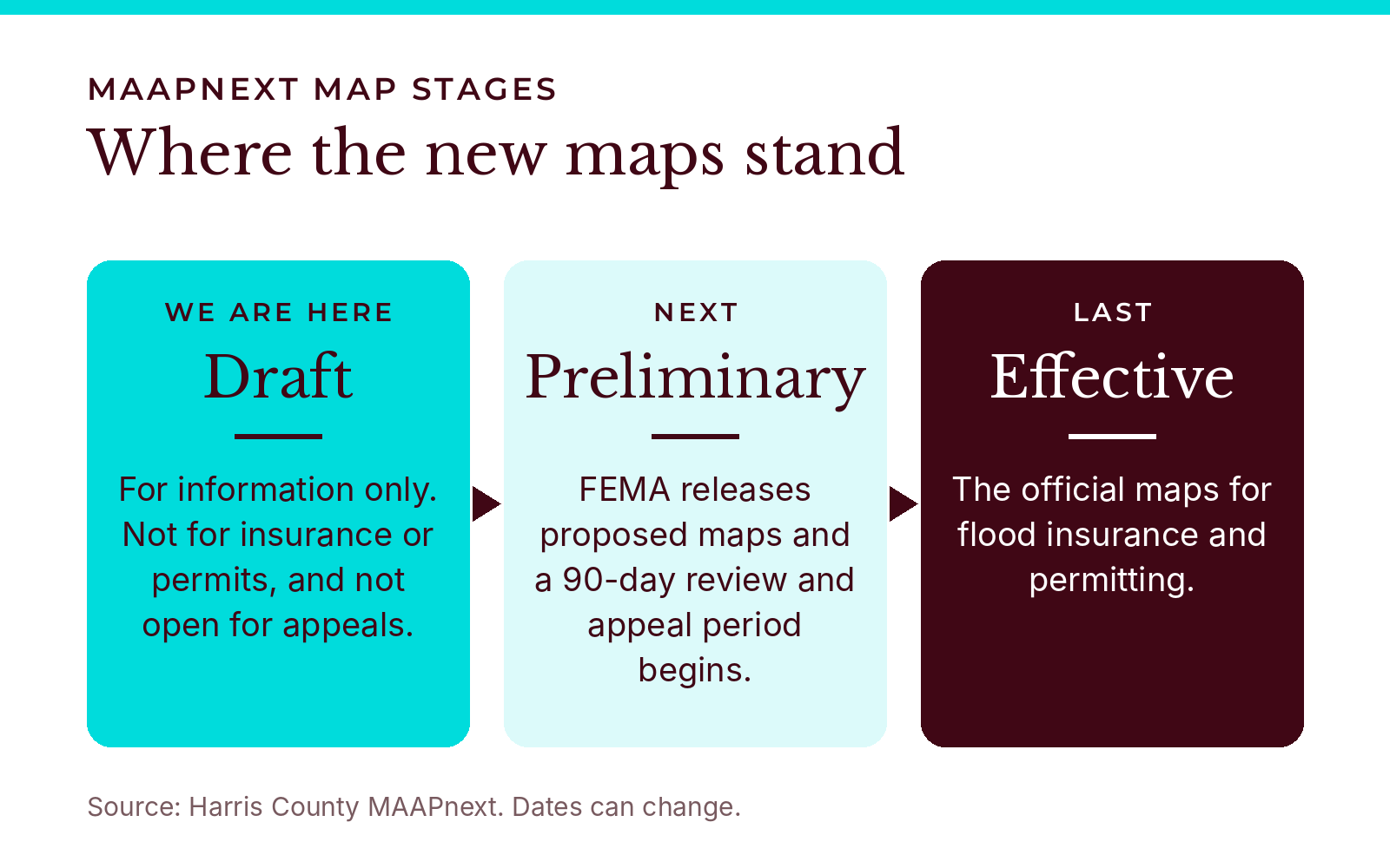
Draft: where we are now. Draft maps are for information only. They can't be used for insurance or permitting, and you can't formally appeal them yet.
Preliminary: FEMA releases proposed maps, and a 90-day review and appeal window opens. That's when an owner can formally challenge a change.
Effective: FEMA finalizes the maps, and they become the official maps for insurance and permits.
As of mid-November 2026, MAAPnext still showed the draft stage with no date for preliminary maps, and it notes that FEMA leads the process and the timeline can change. Back in February, Community Impact reported the county's estimate: an appeal window in early 2027 and final approval in late 2028. In May, the Flood Control District estimated two to three years before new insurance requirements take effect.
We treat every one of those dates as a best guess. For now, the draft map is a heads up, not a verdict.
How to Check if a House Is in a Flood Zone in Houston
When we look up a house for a client, we check two maps, not one. You can do the same thing from your couch.
Look at the draft. Enter the address on MAAPnext to see what the new draft shows.
Look at today's official map. The FEMA Flood Map Service Center has an address search for the current effective map, and you can print a one-page FIRMette. FEMA notes that preliminary maps aren't final and shouldn't be used to make flood determinations.
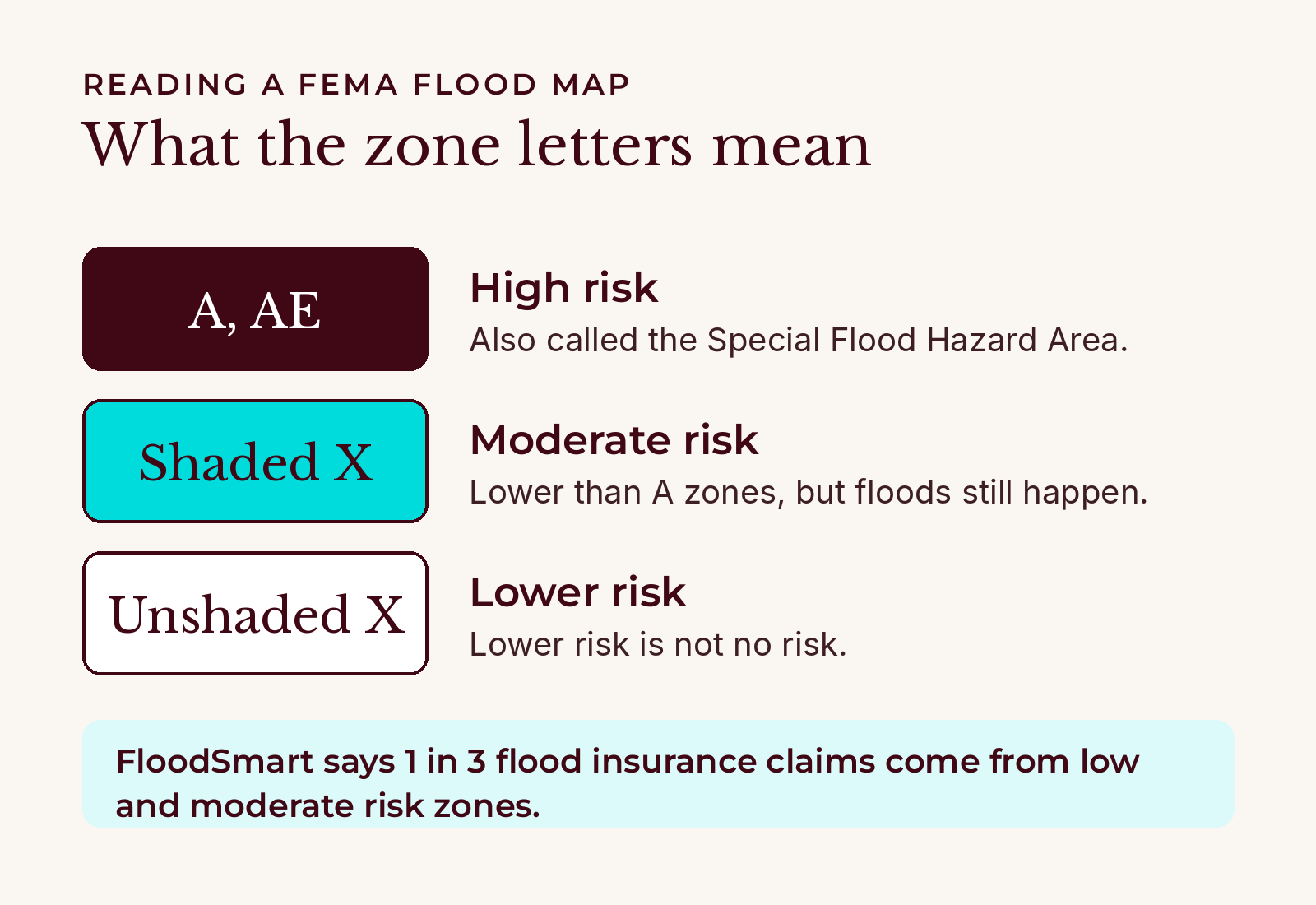
Read the zone. Zones that start with A, like AE, are high risk, also called the Special Flood Hazard Area. Shaded Zone X is moderate risk. Unshaded Zone X is lower risk.
Compare the two. If the draft shows more risk than today's map, that house deserves a few more questions.
Ask about its history. Read the seller's disclosure, and ask whether the home has flooded or had a flood claim.
A map zone never tells the whole story. Lake Houston and the San Jacinto River shape risk here, and so do the streets around a house. One longtime Kingwood resident told Community Impact that floodwater has crossed Kingwood Drive four times, higher each time, even though that resident's own home hasn't flooded.
What a Flood Zone Change Could Mean for Your Insurance and Mortgage
This is where it touches your monthly budget.
If your mortgage is government-backed and the home sits in a high risk zone, flood insurance is required, according to FloodSmart, FEMA's flood insurance site. The drafts don't change that today. Any new requirement would follow the effective maps.
A few things worth knowing before you get a quote:
Your homeowners policy doesn't cover flooding. Flood coverage is its own policy.
Low risk isn't no risk. FloodSmart says 1 in 3 flood insurance claims come from low and moderate risk zones.
Timing can help. If your area is moving into a higher risk zone, FloodSmart suggests buying or renewing before the change. The National Flood Insurance Program also has a Newly Mapped discount for buildings mapped into a high risk zone, if you buy or renew within 12 months of the map update.
The map isn't the only thing that sets the price. FEMA's pricing also weighs the home's elevation, its distance from flooding sources and how it's built.
There's usually a wait. FEMA says many new policies take effect 30 days after purchase, with some exceptions, including when you're buying a home. Your insurance agent can tell you how that applies to you.
What Texas Sellers Have to Tell You About Flooding
Texas sellers generally give buyers a seller's disclosure notice, and since Senate Bill 339 took effect on September 1, 2019, it asks a lot more about flooding. It covers whether the home is in a 100-year or 500-year floodplain, a floodway or a flood pool, whether it has flooded, whether the seller filed a flood insurance claim, and whether the seller got FEMA or SBA help for flood damage.
If a buyer gets that notice after signing the contract, the law gives the buyer seven days to terminate. The form has been updated since 2019, so make sure everyone is using the current version. And if you're selling and you know something from the draft maps, talk it through with your agent.
What We'd Do Right Now
If you're buying, check both maps before you make an offer, and get a flood insurance quote during your option period, not after.
If you already own, look up your address on MAAPnext now. If the draft shows more risk, talk with your insurance agent before the maps become effective.
Either way, keep an eye out for FEMA's preliminary maps. That's when the 90-day appeal window opens, and MAAPnext says notices will be posted on its site.
Lake Houston Flood Maps FAQ
Are the new Harris County flood maps official?
No. As of November 2026 they're drafts for information only. The official maps for insurance and permitting are still FEMA's current effective maps.
When will the new Lake Houston flood maps take effect?
There's no official date yet. County estimates have pointed to 2028, but FEMA has to release preliminary maps and finish a 90-day appeal period first.
Do I need flood insurance if my home isn't in a flood zone?
Your lender may not require it, but it's still worth considering. Many flood claims come from moderate and low risk areas.
Can I appeal a flood zone change?
Yes, during the 90-day review and appeal period that begins after FEMA releases the preliminary maps. Draft maps aren't open for formal appeals.
Talk It Through With Us
Flood maps can feel like a lot, and you don't have to sort them out alone. If you're buying or selling in Atascocita, Kingwood or anywhere around Lake Houston, reach out to us and we'll pull up the address together.
